Day 26
Isafjӧrծur,
Iceland
The
morning was rainy and cool coming up the Isafjarðardjúp,
and in the Skutulsfjörður
to the town. The ship slipped past the buildings to the basins,
pivoted 180º and slipped
sideways to the pier. This gave us on the port side a view of the
pier, fish processors, fishing boats and a half-dozen. Over all this
the majestic mountains stood watch. To our right we could see the
commercial area and the bulk of the homes of the town. To the left
was then uppermost part of the fjord. Iceland was settled sometime
about 875 by Norsemen.
This
community has a population of about 2,700 and its' main industry is
fishing. The port is a walk-off port which means one way get off the
ship and walk into town for food, supplies or entertainment. To find
more about this town, click on ÍSAFJÖRÐUR.
 |
| View of town |
 |
| town from head of the fjjord |
For
this day we had selected a trip across country to see fjords from
land, waterfalls and a fish factory.
Hopefully
more exposure to the culture would be included. I don't need to eat
Puffin or horse to get a taste of the culture, but other elements may
avail themselves. I suspect this may include dried cod.
We
climbed aboard a tour bus and found it was not a full bus today so we
could spread out. Also, the PA system worked so we could hear our
guide. We pulled out of town and up the end of the fjord and
disappeared into a 2 lane tunnel through the mountain, a distance of
about 9 kilometers, or 6 miles through the mountain Breiðadalsheiði.
About ½ way through the tunnel is an intersection (just a
connecting 1 lane tunnel) to another town, which I will describe
later. We continued straight and the road was then 1 lane. I didn't
see any Trolls in the tunnel, but I couldn't see out the front and
all I could see from my side of the bus was ROCK, when there was any
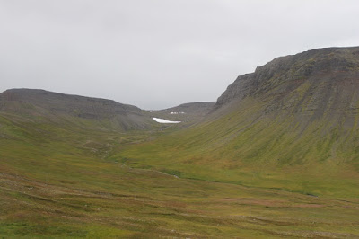
light at all. Our guide explained that we would see 5 fjords today,
and that simply put, a fjord is a deep valley carved out of the
mountains by a glacier and is filled with water from the sea and
streams and rivers. Out of the tunnel we drove alongside then crossed
on a causeway the fjord Önundarfjörður, up and over
Gemlufallsheiði on 60 (the only road), down and along the fjord
Dýrafjörður and up to the small village of Þingyeri. There we
visited public restrooms and looked at a modern replica of a Viking
meeting area. From here we climbed the next mountain,
Hrafnseyrarheiði, on a gravel road full of switchbacks, the turns of
which are slightly wider than the road to accommodate a bus or small
truck and the drop offs were deep. In the spring the road crews may
have to dig down 20 meters through drifts to locate the road and
clear it. When we got to the next fjord, Arnarfjörður, we passed
the home of Icelands independence hero Jón Sigurðsson. On past a
hydroelectric plant and its' falls, down fjord a ways to the
waterfalls Dynjandi.
In 2020 a new tunnel should be complete to provide a year around
access for the hydroelectric plant.
 | |
| Dynjandi Falls |
 |
| At Dynjandi |
The
return trip went the same way, some 87 km. This time we turned off in
the tunnel and went to the eco-friendly (including “Fish Heads for
Nigeria”) fishing village of Suðureyri. The fish factory dressed
us in white lab coats, hair nets and gave us a walk through of the
facility. The section where employees were cleaning and filleting
fish was off limits to photography so no pics there. Then we went on
the “Food Trail” history walk, observed fish drying racks and
tasted air dried cod (the piece of cod which passeth all
understanding) and pickled cod. Shortly after the rain began we went
into a coffee shop where our guide gave us a cooking demonstration on
preparing ceviche with cod. I was hoping someone remembered to bring
Mentos for the trip back.
Back
at the ship the sky was clearing and the sun gave a different
perspective on the bluffs around us. At 1700 we untied, backed out
from our pier, turned to the fjord and steamed out. No whales were
seen on the port side while in the fjord. Once out we turned toward
southern Greenland and followed the Iceland coast for awhile. The
seas were building again and the bridge advised caution in moving
about.
 | |
| in port. view from our cabin. |
 | |
| looking forward from our deck |
 |
| on departure |
 |
| leaving the fjord |
Advice
for visiting here by ship: Bring or buy Kroners. Visa widely
accepted. Consider a good chart/map such as the National Geographic
Adventure Travel Map Iceland (#3302).


No comments:
Post a Comment